Harita Mühendislik ve Danışmanlık Hizmetleri +90 312 432 01 60 +90 546 216 42 86

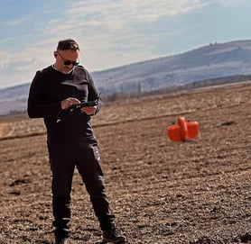
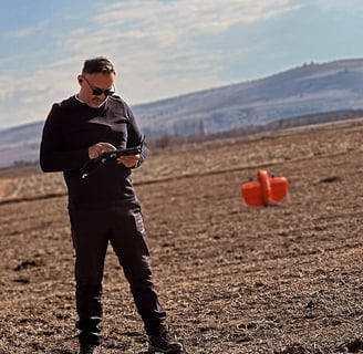
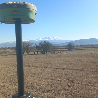
Uzman ekibimizle projelerinizi hayata geçiriyoruz.EMR Harita ve Mühendislik Hizmetleri Şirketi yurt içinde yüksek hassasiyetteki sonuç ölçümleriyle güvenilir, hızlı ve ekonomik çözümler üreten harita ve mühendislik hizmeti vermeyi amaçlayan bir kuruluştur.Hâlihazır harita üretiminden yol projelerine, deformasyon ölçümlerinden statik ve RTK GPS ölçümlerine, batimetri ölçümlerinden mekânsal bilgi sistemine, her türlü şantiye ölçümlerinden tevhid-ifraz-yola terk gibi klasik haritacılık hizmetlerine kadar birçok alanda hizmet veren EMR Harita ve Mühendislik Hizmetleri uzman kadrosuyla uygulama yelpazesinde sınır tanımamaktadır.Projenin gereksinimlerine bağlı olarak günlük, aylık gibi süreli olarak ekip hizmeti yada proje bazlı uygulamalarla, her türlü danışmanlık ve mühendislik hizmeti sunan EMR Harita, Ulusal ve evrensel boyutta mesleki etik değerlerden ödün vermeden topluma, çevreye, çalışanlarına, paydaşlarına ve işbirliği içerisinde bulunduğu meslek gruplarına faydalı çözümler üretmek, faaliyettebulunduğu projelerle toplumun refahına katkıda bulunmak, müşteri memnuniyetini ön planda tutarak yarattığı güven, iyi niyet ve çözüm ortaklıkları ile ileriye dönük yatırımlar yapmak, iş gücünü ve hizmet kapasitesini büyütmek, teknolojik ve çağdaş çözümlerle sektördeki öncü duruşunu korumayı kendisine vizyon edinmiştir.Mesleki etik değerler çerçevesinde teknolojik gelişmeleri bünyesinde barındıran, uydu ve bilgisayar teknolojisinden yararlanarak kamu ve özel kurum projelerine optimum maliyet ve yüksek kaliteli mekansal verinin edinimine yönelik çağdaş çözümler üreten Sur Harita, müşterilerinin ihtiyaç ve taleplerine en kısa zamanda ve en doğru şekilde cevap verecek şekilde hareket edere, Autocad, Autocad Civil 3D, Macrostation, Eghas, LGO, TGO, ve Arcgis gibi yazılımlar ile proje odaklı çözümler sunar.

EMR Mühendislik olarak ;

  • Evrensel değerlere bağlı, müşterilerimize en hızlı ve güvenilir hizmetleri sunmak ,

  • Müşterilerimizin ihtiyaçlarına günümüz teknolojik koşulları ve yasal çerçevede çözümler sunabilmek ,

  • Müşterilerimize katmadeğer sunabilmek misyonu ile faaliyetlerimize devam etmekteyiz.

Vizyonumuz

Her geçen gün daha büyüyen ve profesyonelleşen kadromuz ile Mühendislik ve Danışmanlık Hizmeti verdiğimiz her alanda çevreye duyarlı iş sağlığı güvenliği ve kurallarını uygulayan ve gözeten, yenilikçi, kendini geliştiren hizmet kalitemiz ve başarımız ile daima ihtiyaç duyulan ve sektörün öncü firmalarından biri haline gelmektir.

FAYDALI LİNKLER

Several individuals are gathered, focusing on a map held by one person. The person holding the map is wearing a gray jacket and carrying a backpack, indicative of a hiking or outdoor setting.
An architectural sketch appears on a desk, featuring a colored floorplan with measurements. Various tools and drawing supplies, including pens, a ruler, and an eraser, surround the plan. The drawing includes notes and uses vivid colors to highlight different sections.
An aerial view of a cityscape featuring a large rectangular office building at the center. The surrounding area includes a mix of residential and commercial buildings, tree-lined streets, and open green spaces. The architecture is varied, with both older brick structures and more modern constructions. Roads intersect at various points, and there is visible urban planning with circular intersections and organized blocks.
A detailed map with intricate blue lines displays a network of streets and canals, resembling the layout of a historical city or district. The map is printed on a slightly translucent surface with its corners fastened by screws. The number '1724' is visible in the bottom right, potentially indicating a date or map reference.
A hand with a finger pointing at a colorful map, which appears to be a theme park or amusement park layout. The map is detailed with various attractions, pathways, and labeled areas, surrounded by vibrant colors and illustrations.
A detailed architectural scale model of an urban area featuring a variety of buildings arranged around a central waterway. The structures are made from wood and have a mix of geometric shapes. There are simulated roads and pathways with evenly spaced trees, some arranged in circular patterns. The model includes a prominent bridge structure crossing the water and connecting different parts of the area.